More heavy rain overnight means the River Severn has now breached emergency defences in Shrewsbury.
More wet weather is forecast in some of the worst-affected areas, with parts of Wales and the North West of England predicted to see another 0.8in to 1.6in (2cm to 4cm) of rain, according to the Met Office.
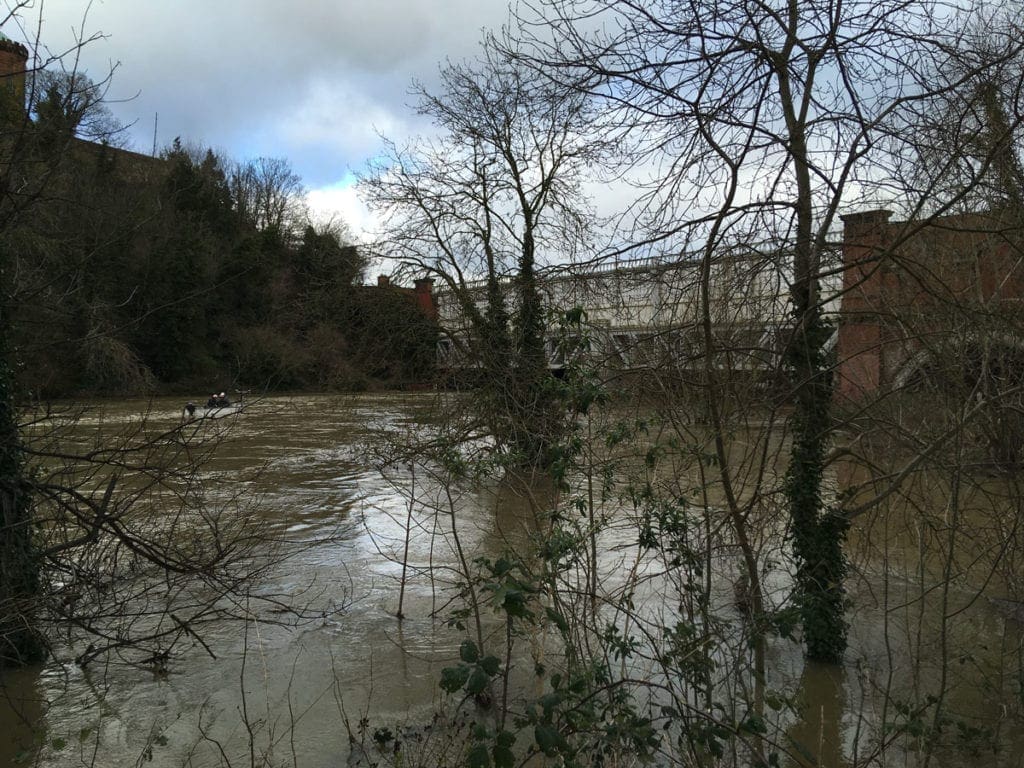
Railway lines into Shrewsbury were closed due to the rising water levels close to the viaduct.
From the history of steam through to 21st century rail transport news, we have titles that cater for all rail enthusiasts. Covering diesels, modelling, steam and modern railways, check out our range of magazines and fantastic subscription offers.
‘Once-in-a-generation event’
Network Rail said: “The exceptionally high-water levels in the Severn and the closure of these lives serve to highlight the extreme weather we’ve experienced across the network over the last few weeks.
“The current situation in Shrewsbury is very much a once-in-a-generation event.”
It said engineers would be undertaking an underwater inspection of the viaduct’s structure on Wednesday morning before lines can reopen.
Network Rail tweeted that their aim is to reopen the lines and “reconnect the community with the rest of the county.”
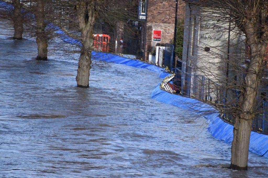
Residents in the Worcestershire town of Bewdley were forced to evacuate after the river spilled over barriers at Beales Corner.
Mark Bowers, a flood risk manager at the Environment Agency (EA), tweeted: “Huge amounts of water in the system. Thoughts with the local community who have been impacted.”
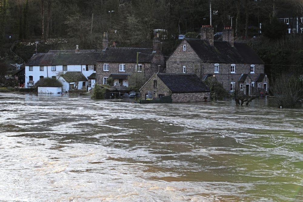
In the at-risk town of Ironbridge in Shropshire, the force of the river forced flood defences backwards, although they managed to hold.
Shortly after 1am on Wednesday, Chief Superintendent Tom Harding, of West Mercia Police, tweeted: “The barrier appears intact but has indeed moved. This will be monitored throughout the night.”
Speaking at Ironbridge on Wednesday morning, Marc Lidderth, EA environment manager, said water levels had dropped by about 0.3in (1cm).
But he added: “The severe flood warning that we have issued here at Ironbridge is still in force, which means there is a significant risk to life, so we need people to remain vigilant and to listen to the advice that’s coming from the emergency services.”
He said that although the barriers had moved, they were still holding water and the over-topping the EA had feared had not happened.
The agency is keeping a close eye on the barriers on the Severn, Mr Lidderth said. He added that drones may be used later today to assess the defences.
Roads around the Ironbridge Gorge have also been closed to stop people driving in floodwater, Telford and Wrekin Council said.
The level of the River Severn reached more than 22ft (6.79m) in the Shropshire village of Buildwas at around 8.30am on Wednesday – up from a level of 16ft (4.19m) on Sunday.
On Wednesday morning there were two severe flood warnings – meaning there is a risk to life – on the River Severn.
There were a further 102 flood warnings and 146 flood alerts in place stretching from the Lake District down to the south coast, with heavy concentrations in the North East and South West.
Many towns the length of the River Severn were also at risk.
Oli Claydon, a spokesman for the Met Office, said western parts of the UK would see a pattern of sunshine and showers over Wednesday and Thursday.
He said the volume of rain would ordinarily “be nothing to be overly concerned about”, but added any further rain could have an impact on flooded communities.
“In some of those regions through that period of rainfall, particularly into the Severn catchment, the total won’t necessarily be a huge amount but in any of those places that are seeing flooding, any further rain is not welcome,” he said.
Mr Claydon said that most of the UK would be dry by Thursday evening, before more heavy rain moves in from the west on Friday.
“In terms of impact, the main thing we are keeping an eye on now is Friday,” he said.
“That is another area of concern – there could be yellow rain warnings on Friday in terms of the accumulations that could be expected from that rainfall.”
He said south-west England, southern parts of Wales and north-west England were expected to see the most rain on Friday and into the weekend.